Scotland's Devastating Dava Wildfire, Photographing and Mapping The Aftermath : Field Notes
Location: Dava and Carrbridge - North of Cairngorms National Park
Date: 26/08/2025
Context: During June/July of 2025, areas between Dava and Carrbridge became the backdrop for Scotland’s biggest wildfire to date (McKenzie, 2025). The extent of this wildfire reached nearly 10,000 hectares. On the 26th August 2025, I decided to visit an area of the wildfire destruction surrounding Loch Allan on Dava Moor and photograph the aftermath. Toward the end of this blog post I have also included some rough and ready map analysis, showing you the approximate extent of this wildfire.
A feeling of loss overwhelmed me as I stepped out from the deep green ancient forest and into a scorched opening, the former blazing grounds of the Dava wildfire.

Image 1 - scorched pine trees. Some have fallen right to the ground, others are trying to hang on and some are still standing, but perhaps not so strong. Orange leaves give the impression of Autumn on a warm Summer’s day in August.
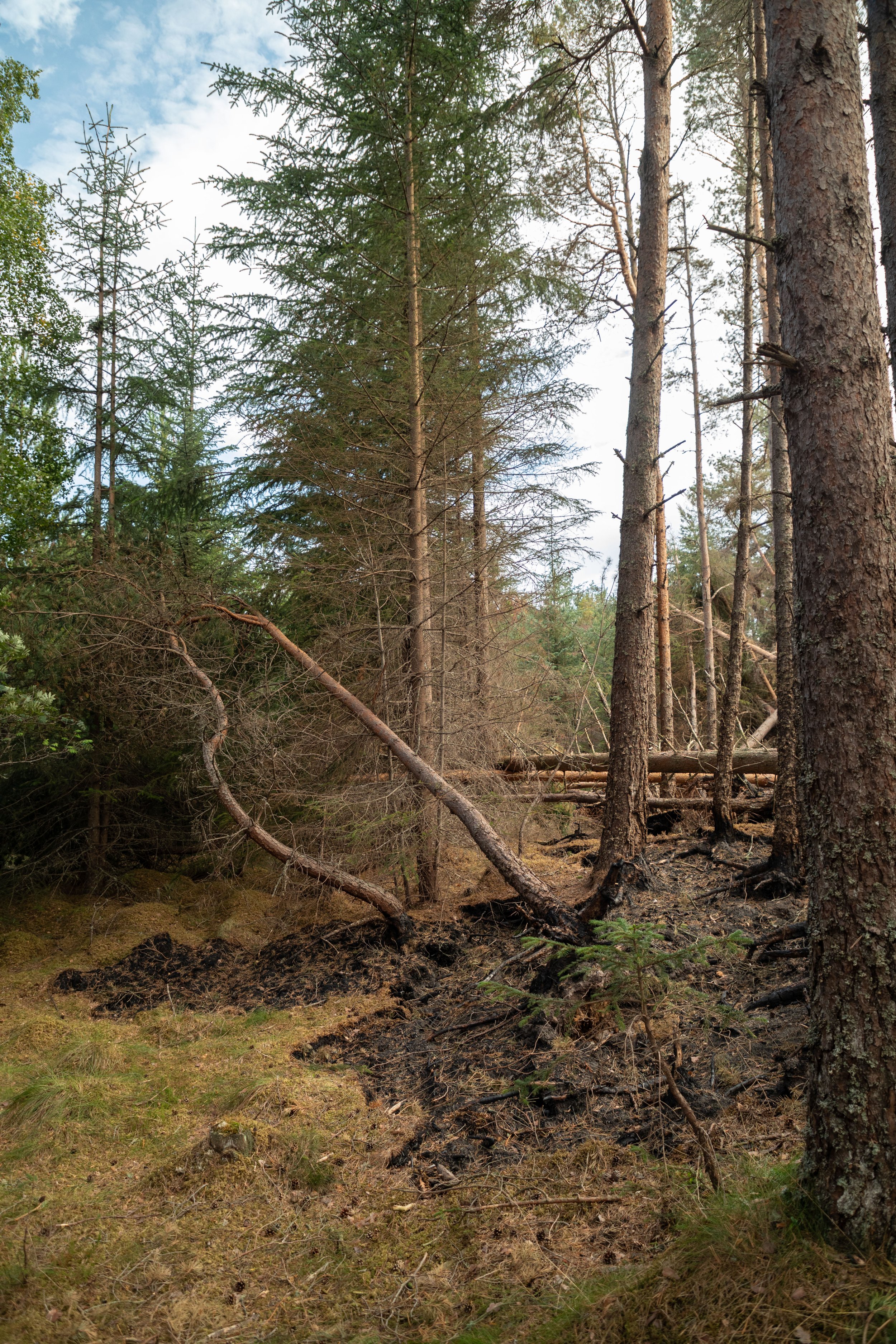
Image 2 - fire boundary can be seen.
The fire has left a scar with rippling boundaries and just a quick glance could have you imagining lava oozing over the forest floor (image 2).
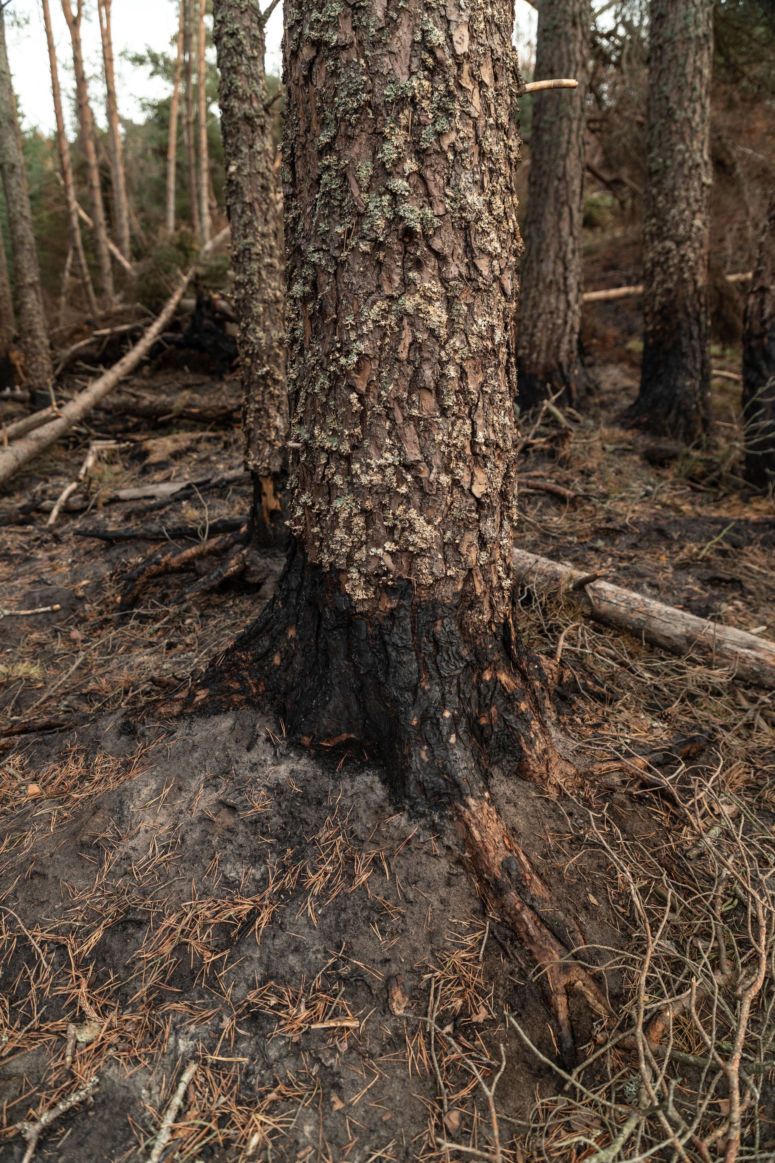
The boundary marks a moment now frozen in time, a moment where lives of trees and wildlife were saved and others lost, destruction halted.
Although not fully in possession of the facts yet, I can only presume the fire was halted here intentionally through the hard work of the emergency services. This section was located right next to the road and so perhaps logistically it allowed quick access to tame this part of the fire?
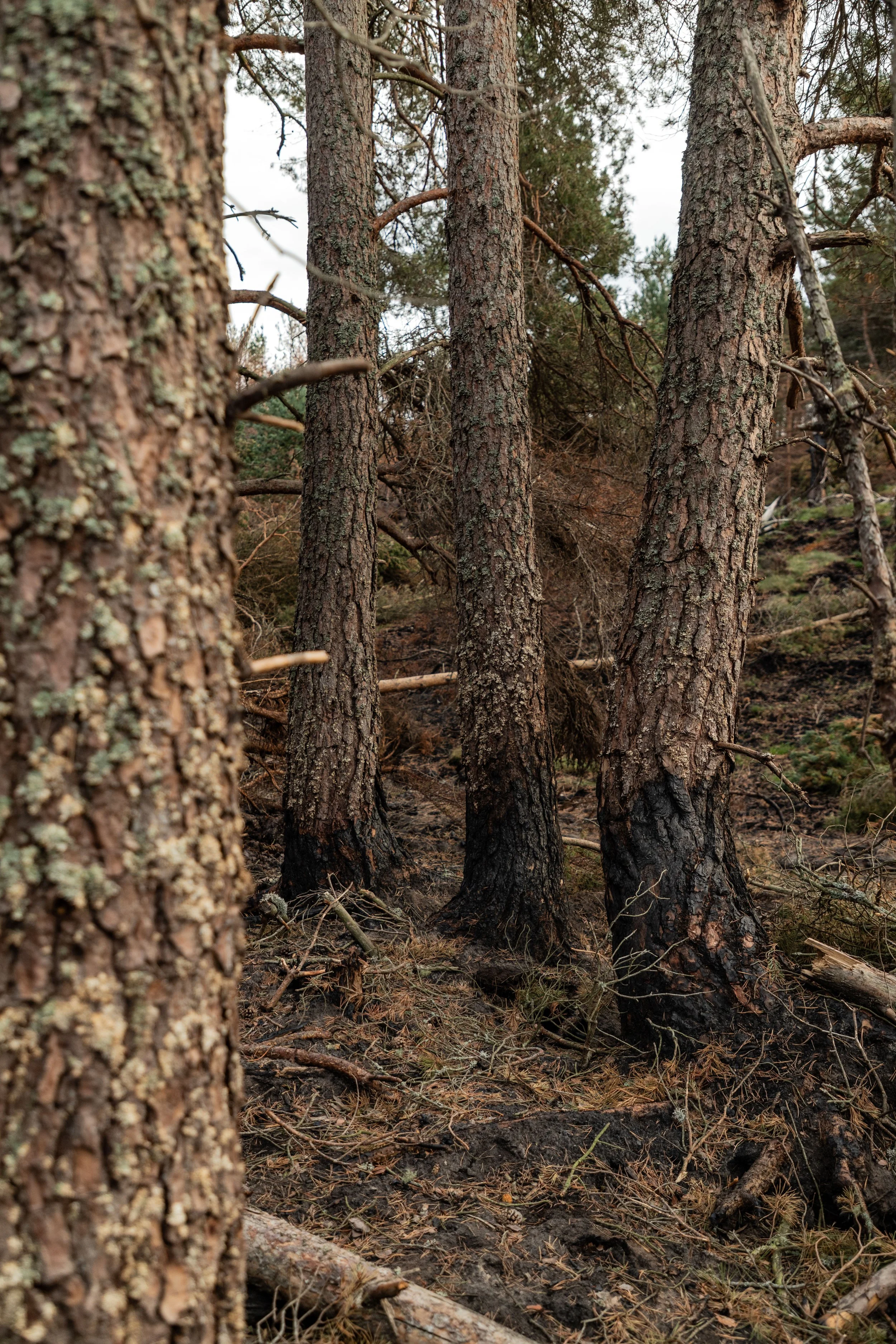
Through the corner of my eye I thought I saw a person standing still upon the hill. It gave me a slight chill and I quickly turned my gaze directly to them. ‘Them’ turned out to be the lonely charred trunk of a tree that had been ravaged by the flames. The most harrowing sight of them all. It was clear this tree had once stood tall and proud in its forest, thriving and supporting life all around (Image 3).
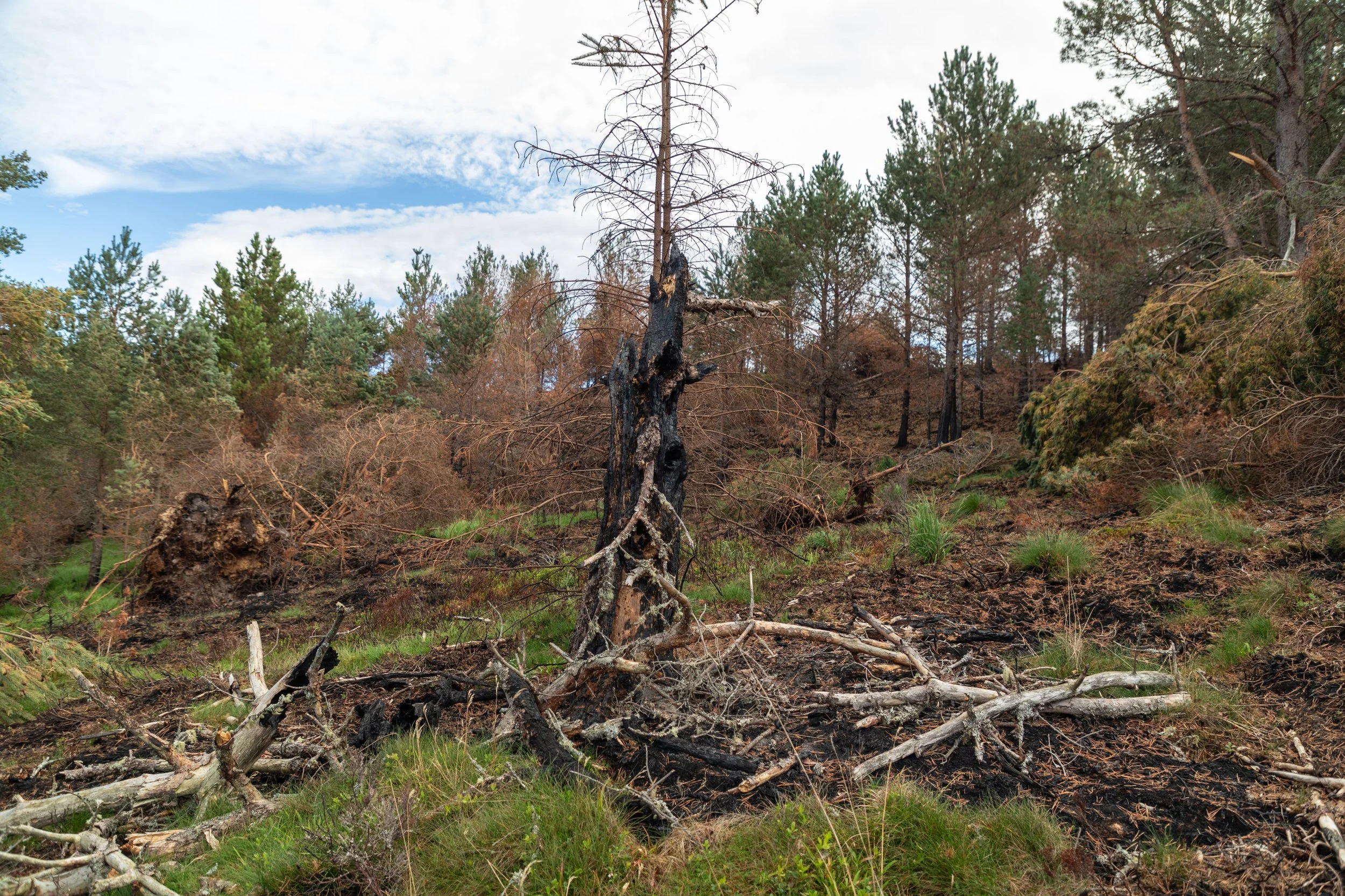
Image 3 - ravaged and charred tree.
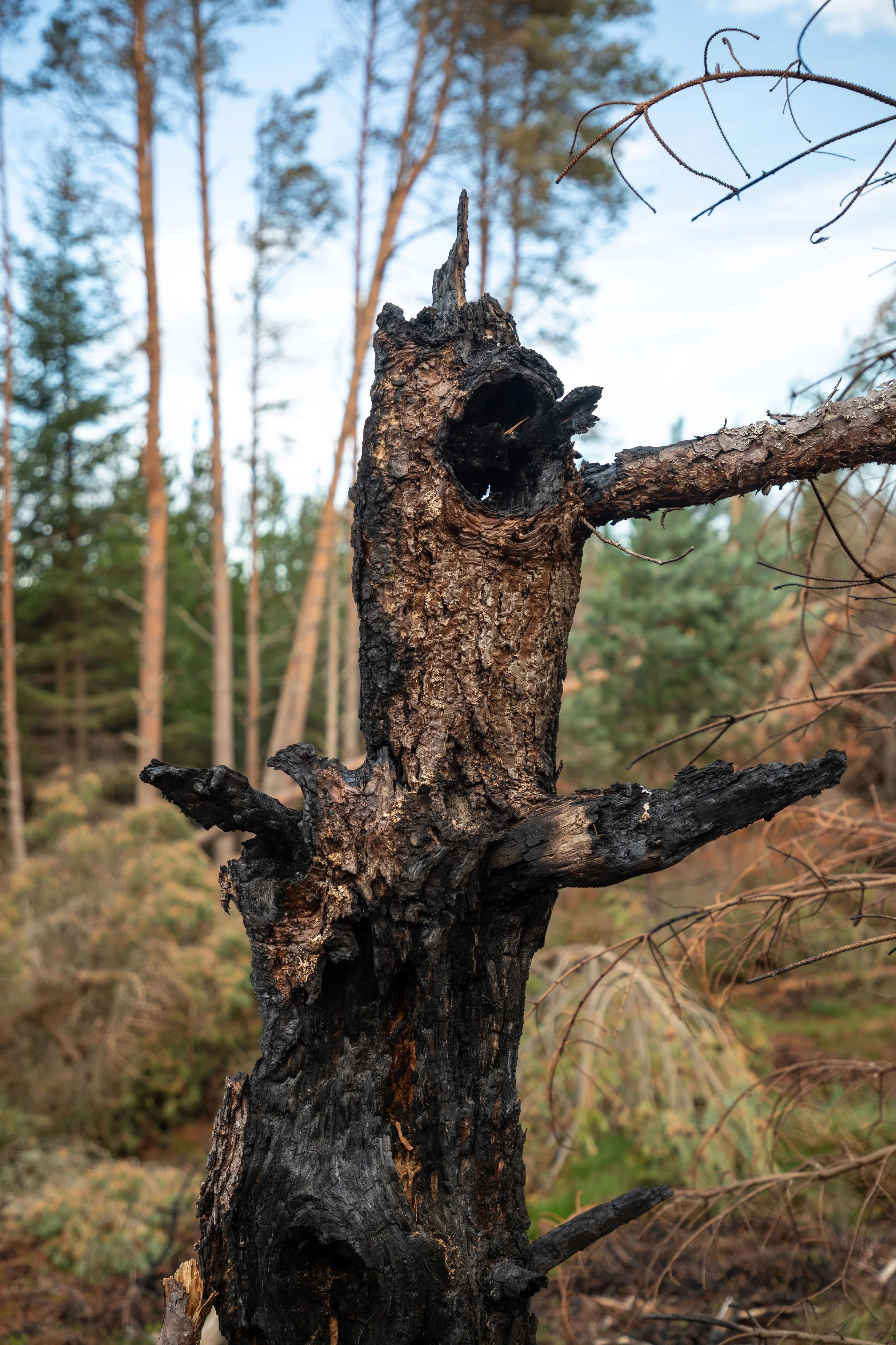
I found it strange when I came across patches of almost white vegetated mounds amongst the blackened forest floor (Image 4). Thinking back to the thriving and lush forest that this used to be, I realised these could be clusters of moss, but how would moss survive fire? Could this be sphagnum moss? Although not lush and bright green anymore, the moss was very much still intact. However, now the moss looked much more like the bleached brain coral you would see in slightly more acidic oceans. I guess the moss before me and the bleached brain coral have something in common. Both have been destroyed by humans.
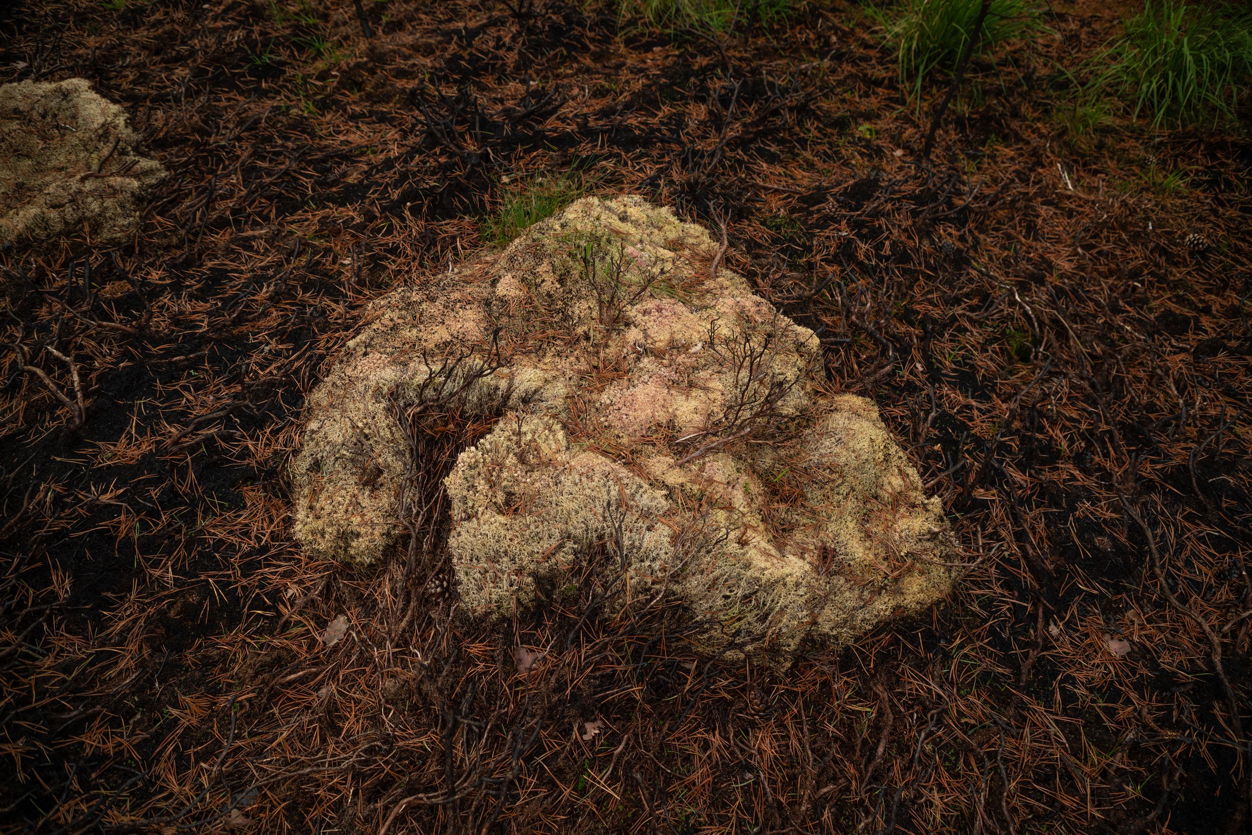
Image 4 - moss that could be mistaken for bleached brain coral.
Returning home, I decided to do my own quick (emphasis on the quick) analysis to understand the extent that the fire had reached. To do this, I obtained satellite imagery at 10 metres resolution and applied an indices known as the Normalised Difference Vegetation Indices (NDVI), this helped me to distinguish the boundary of the fire more effectively (Image 5). It is important to note that the below includes fire extents from both Dava and Carrbridge fire, of which are separated by the A939.
Image 5 - NDVI layers extracted from Sentinel-2 imagery, top shows before fire image from May 2025, bottom shows after fire image from August 2025.
The dramatic change that I saw when comparing between satellite imagery from before to after the fire absolutely shocked me, I hadn’t truly understood how far this fire had spread across the landscape.
As I stated before, my analysis was quick. Some things to bear in mind when looking at these maps and my analysis is that: 1) part of the imagery is cut off 2) I didn’t take much time to define a truly accurate range of NDVI values for the burn area. However, you can find a much more thorough analysis shown on the Scottish Wildfire Forum (SWF) here.
My analysis was not far off though and I calculated a fire size of approximately 9854 hectares (Image 6), slightly over the official predictions but this is to be expected due to my rough and ready process.
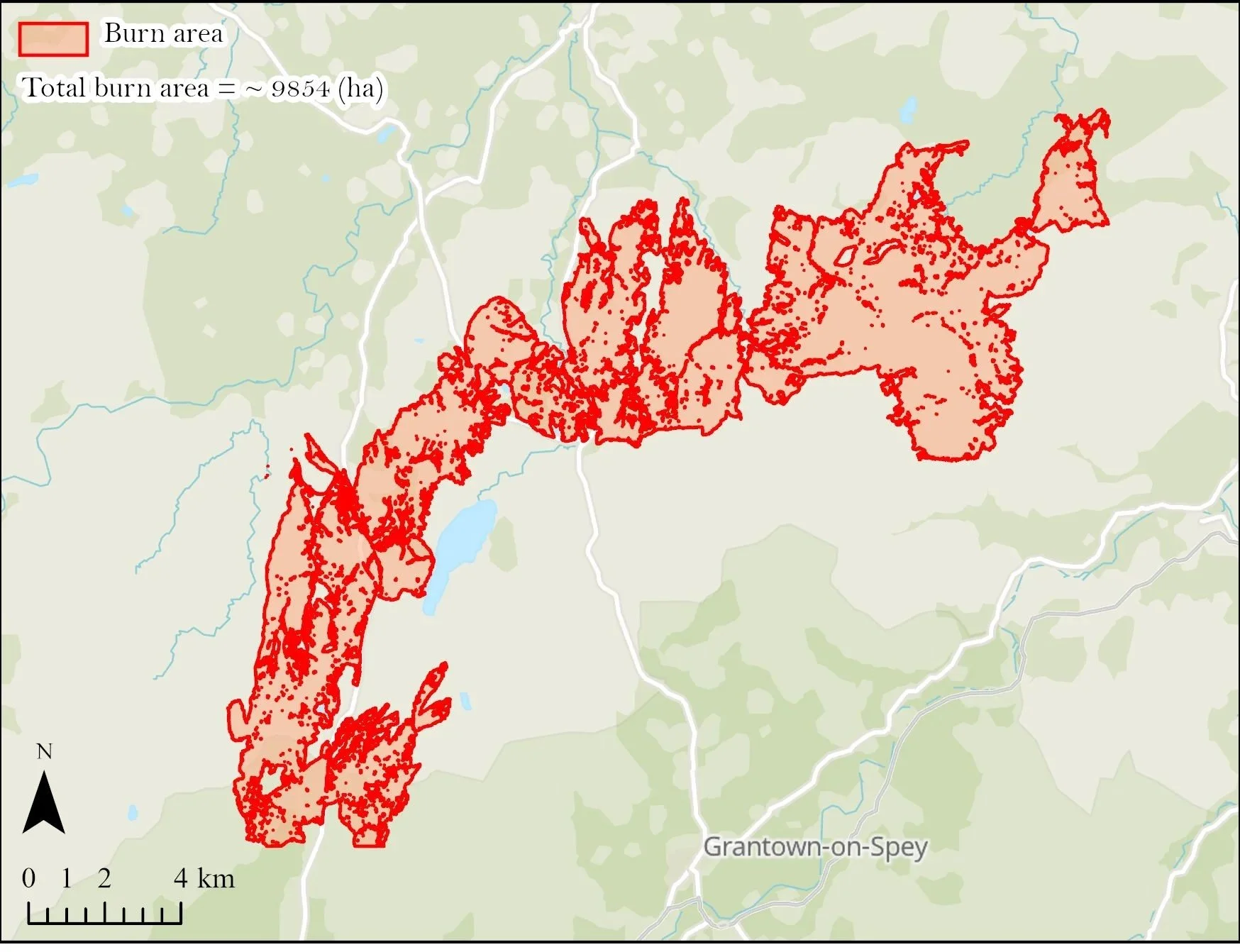
Image 6 - calculating the difference between the NDVI layers (after - before) I was able to isolate the fire area and convert this into a polygon that I could then measure. I calculated the area to be ~9854 hectares. Contains OS data © Crown Copyright and database right 2026.
References:
McKenzie, S. (2025). Highland wildfires were ‘biggest in Scotland’s history’. BBC News. [online] 17 Jul. Available at: https://www.bbc.co.uk/news/articles/cn81nl1n2v5o.